Blegberry
Copyright © Mark Jordan
Blegberry Beach is a west facing beach situated about half a mile north of Hartland Quay on the North Devon Coast.
The beach consits of rocks and pebbles with a little sand uncovered at low tide. A feature of the beach is the dramatic geology cut in places by waterfalls tumbling down from the cliffs above. Access is along the Coast Path - a 20 minute or so walk from Hartland Quay.
The sheer cliffs rise over 600 feet from the sea and care should be exercised whilst in the area. To the north lies Damehole Point, a rocky cove midway between Hartland Point and Hartland Quay, whilst to the south lies Dyer's Lookout.
The South West Coast Path runs south towards Hartland Quay, Speke's Mill Mouth, Welcombe Mouth and the border with Cornwall. To the north lies Hartland Point, Shipload Bay and Clovelly as you enter Barnstaple Bay.
Facilities
✔ Dogs permitted
✔ Interesting geology
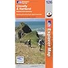
OS Explorer Map 126: Clovelly & Hartland

This map is part of the Ordnance Survey's Explorer series designed to replace the old Pathfinder map series. At 1:25,000 scale this detailed map shows a host of attractions including gardens which are open to the public, nature reserves and country parks as well as all official footpaths, bridleways, roads and lanes. Other facilities covered include: camping and caravan sites, picnic areas and viewpoints, selected places of interest, rights of way information for England and Wales, National Trail and Recreational Path routes, and selected tourist information. The series is aimed mainly at the experienced map user but can be used by tourists and locals alike.
Local area
Holiday Parks
Stay at a nearby Holiday Park and keep the kids amused all day! Parks in the vicinity include those at:
![]() Westward Ho!
Westward Ho!
Hotels
Plenty of hotels are available locally. Consider those in the local towns:
![]() Hartland
Hartland
![]() Westward Ho!
Westward Ho!