Welcombe Mouth
Welcombe Mouth lies at the seaward end of a steep valley about half a mile north of Marsland Mouth on the North Devon coast.
The beach is west-facing and consists of pale golden sand backed by pebbles and is cut by rocks and rocky reefs.
Above the beach a small stream is crossed by circular stepping stones. Parking is available for a few cars in the small car park so if you wish to visit be sure to arrive early.
Access to the beach is gained via a narrow road leading down from the hamlet of Welcombe inland.
Welcombe Mouth lies within the Marsland to Clovelly Coast ‘SSSI’ (Site of Special Scientific Interest), ensuring that its geological, geomorphological and biological importance is recognised:
'The cliffs at Welcombe Mouth have been identified as a Geological Review site because of their exposures through Upper Carboniferous rocks belonging to the Crackington and Bude formations. The rocks are affected by large-scale folds, which may be vertical or horizontal, and are formed by sandstone beds alternating with shale'.
'Around Welcombe Mouth there are clifftop grassland communities supporting species such as thrift, red fescue, wild carrot, buckshorn plantain, wild madder, wild thyme and kidney vetch. Kidney vetch is also found in a number of colour forms here. As well as its normal yellow form, there is also a crimson variety, but it can also be white, cream and purple'.
Steep paths lead north from Welcombe Mouth to Knap Head, Embury Beacon and South Hole or to the south the South West Coast Path climbs to the 400ft high (122m) cliffs above Marsland Mouth and the county boundary with Cornwall.
Facilities
✔ Parking
✔ Flora and Fauna
✔ Dogs permitted
✔ Interesting geology
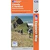
OS Explorer Map 126: Clovelly & Hartland

This map is part of the Ordnance Survey's Explorer series designed to replace the old Pathfinder map series. At 1:25,000 scale this detailed map shows a host of attractions including gardens which are open to the public, nature reserves and country parks as well as all official footpaths, bridleways, roads and lanes. Other facilities covered include: camping and caravan sites, picnic areas and viewpoints, selected places of interest, rights of way information for England and Wales, National Trail and Recreational Path routes, and selected tourist information. The series is aimed mainly at the experienced map user but can be used by tourists and locals alike.
Local area
Holiday Parks
Stay at a nearby Holiday Park and keep the kids amused all day! Parks in the vicinity include those at:
![]() Westward Ho!
Westward Ho!
Hotels
Plenty of hotels are available locally. Consider those in the local towns:
![]() Hartland
Hartland
![]() Westward Ho!
Westward Ho!
Caravans
In the vicinity is a choice of camping and caravan sites offering high quality, affordable holiday accommodation. Consider camps in Bude, Bideford, Torrington and Highampton.