Dawlish Warren
Granted a Blue Flag Award for 2015, Dawlish Warren lies at the mouth of the River Exe, directly opposite Exmouth on the South coast of Devon.
Situated just to the northeast of Dawlish, it is a popular resort in its own right. A favourite with families, campers and caravanners, the area also has a number of holiday chalets.
The beach is almost a mile long and consists of sand and shingle with the characteristic groynes attempting to stabilise the coastline. There are a number of outlets offering refreshments or deckchair hire as well as a few gaily coloured beach huts and amusements just behind the beach
The sandy bar area is a birdwatcher's paradise as all manner of waterfowl and other birds pause here to feed in the estuary of the River Exe, in their thousands.
Dawlish Warren National Nature Reserve covers about 500 acres and is an area of grassland, sand dunes, mudflats surrounding the main mile and a half long beach and sandspit.
To ensure the survival of the unique habitat, there is open access to the majority of the Reserve including the bird hide at all times. There is however no public access to the golf course or mudflats at any time. The Visitor Centre is open in season from April to September between 10:30am and 5:00pm but closes for lunch between 1pm and 2pm. Please be advised that there are no toilets at the Visitor Centre or on the Nature Reserve.
Out of season, dogs can be taken over a large area of the beach, between groyne 4 and groyne 9 but are not allowed on the dunes, beach or mudflats beyond groyne 9 as far as Warren Point. Please consult local signage for more information.
Water taxis operate between Dawlish Warren and Exmouth in season - see the local press for more information.
Facilities
✔ Parking
✔ Toilets
✘ Total dog ban
✔ Easily accessible
✔ Sandy beach
✔ Family friendly
✔ Good Surfing
✔ Lifeguard in summer
✔ Cafe, shop or pub
✔ Flora and Fauna
✔ Telephone
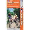
OS Explorer Map 110: Torquay & Dawlish

This map is part of the Ordnance Survey's Explorer series designed to replace the old Pathfinder map series. At 1:25,000 scale this detailed map shows a host of attractions including gardens which are open to the public, nature reserves and country parks as well as all official footpaths, bridleways, roads and lanes. Other facilities covered include: camping and caravan sites, picnic areas and viewpoints, selected places of interest, rights of way information for England and Wales, National Trail and Recreational Path routes, and selected tourist information. The series is aimed mainly at the experienced map user but can be used by tourists and locals alike.
Local area
Holiday Parks
Stay at a nearby Holiday Park and keep the kids amused all day! Parks in the vicinity include those at:
Hotels
Plenty of hotels are available locally. Consider those in the local towns:
![]() Dawlish
Dawlish
![]() Exmouth
Exmouth
![]() Teignmouth
Teignmouth
Caravans
In the vicinity is a choice of camping and caravan sites offering high quality, affordable holiday accommodation. Consider camps in Newton Abbot, Paignton, Brixham and Moretonhampstead.