Preston Sands
Preston Sands beach lies just north of Paignton Sands at the heart of Torbay on the coast of South Devon.
Southeast-facing the beach runs from its boundary with Paignton Sands northeast to Hollicombe Head. Consisting of typical red Devon sand, Preston Sands has easy access and excellent facilities, but is rather let down by limited parking nearby. Parking is better advised at Paignton.
Often extremely busy due to its proximity to the town, the long beach is backed by a pleasant level promenade. All the usual facilities lie within easy reach including beach shop and cafés. The brightly painted chalets and deckchairs are available for hire.
The long sandy beach Preston Sands was recently awarded a Quality Coast Award and is superb for making sandcastles. It offers plenty of room to sunbathe or swim. At the northern end of the beach, younger members of your party may enjoy exploring the rock pools uncovered by the outgoing tide.
The beach is supervised during the summer season. First aid, lost child centre, warning flags and patrol boat are all available during the summer season. Lifebuoys are available all year round.
The grassy area of Preston Green behind the beach is a great place for a game of football or cricket.
Disabled access is good as the area is quite flat for wheelchairs or those with impaired mobility. There are Disabled visitors spaces in the car park and the Disabled toilet facilities are open all year.
A seasonal dog ban is in force on Preston Sands. Dogs are banned between 1st May and 30th September inclusive. There is however a dog exercise area on the Green.
Paignton Zoo Environmental Park lies less than two miles from the beach, whilst the resorts of Torquay and Brixham are just a short drive away.
Facilities
✔ Flora and Fauna
✔ Sandy beach
✔ Easily accessible
✔ Cafe, shop or pub
✔ Family friendly
✔ Parking
✔ Toilets
✘ Seasonal dog ban
✔ Telephone
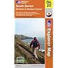
OS Explorer Map OL20: South Devon

This map is part of the Ordnance Survey's Explorer series designed to replace the old Pathfinder map series. At 1:25,000 scale this detailed map shows a host of attractions including gardens which are open to the public, nature reserves and country parks as well as all official footpaths, bridleways, roads and lanes. Other facilities covered include: camping and caravan sites, picnic areas and viewpoints, selected places of interest, rights of way information for England and Wales, National Trail and Recreational Path routes, and selected tourist information. The series is aimed mainly at the experienced map user but can be used by tourists and locals alike.
Local area
Holiday Parks
Stay at a nearby Holiday Park and keep the kids amused all day! Parks in the vicinity include those at:
Hotels
Plenty of hotels are available locally. Consider those in the local towns:
Caravans
In the vicinity is a choice of camping and caravan sites offering high quality, affordable holiday accommodation. Consider camps in Paignton, Brixham, Newton Abbot and Kingsbridge.